We have this beautiful sunny day at Yosemite Creek above the falls. Wall to wall blue sky. Except that the forecast picked up on our weather radios says the same thing the Ranger said before we left....and the same thing we had seen all through this trip: changeable conditions at the very least. Actually, the local 24 hour forecast said a liklihood of up to 12 inches of snow in the higher elevations and changeable winds with strong gusts. The valley could look forward to overcast skies and precipitation, rain or snow depending entirely on the microclimate.
We talked about an action plan. If there is lots of snow, then continuing past Indian Ridge and down Snow Creek is a very stupid and dangerous choice. If we're on top and snow comes of that magnitude, then we'll be coming down Yosemite Falls switchbacks basically blind, and we don't have heavy snow gear and crampons. So after some discussion, with the sun beating down and blue sky all around, we decide to spend the early day around the overlook and Yosemite Point, and then head down in the later afternoon just in case.
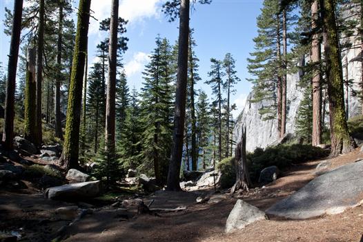
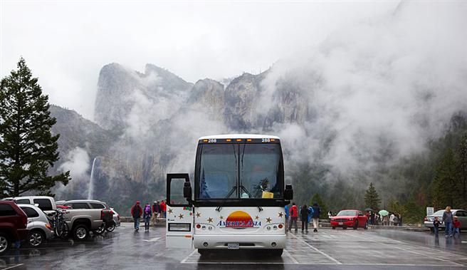
At the Yosemite Falls trail junction early in the day
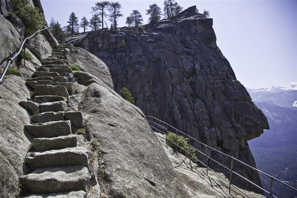
Nearby where Yosemite Creek takes its tumble over the edge, there's a secluded set of stairs leading down to an overlook.
Another secluded stairway
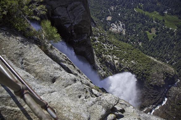
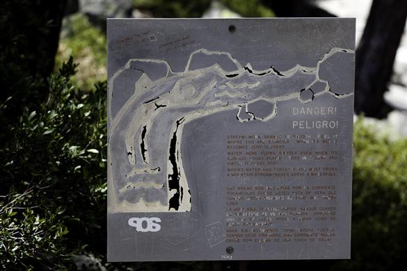
To get to Yosemite Point from the top of the falls, we backtrack along the creek to reach the bridge. Then it's time to pump water, being really careful not to slip. With the low water level there are plenty of relatively safe places to get to the edge on flat expanses. After many years, I don't need the sign to tell me it's slippery when wet.
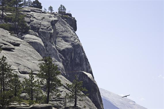
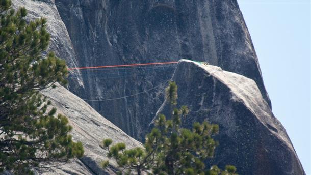
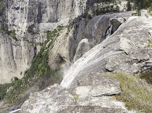
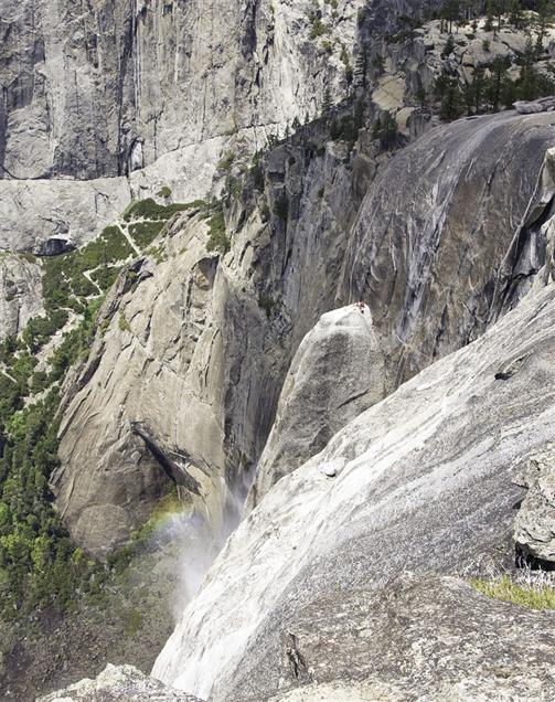
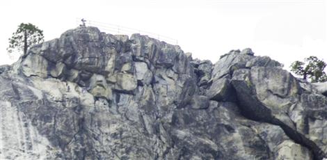
With a telephoto lens, I'm looking at Yosemite Point (the railing at the edge) and you can see the top of Lost Arrow spire. Notice the traversing ropes; we'll have a better look at them later. Remember this perspective and compare it with the view from the point. On such a sunny day (so far) the thermals coming up the warm rock make it easy for birds to gain altitude fast.
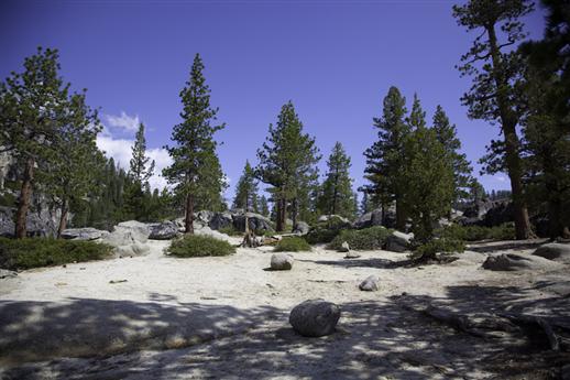
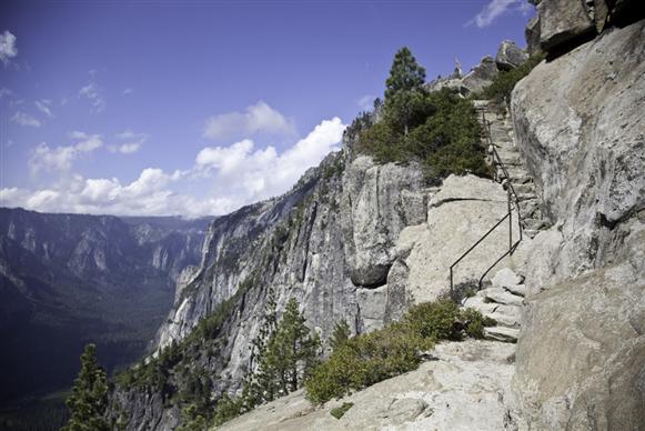
From the bridge it's a good 30 minutes hiking to the point-first up zigzags on a bare sloping rockface leading up from the creek, and then through treed sections before coming out on the sandy top.
Two views from a previous trip
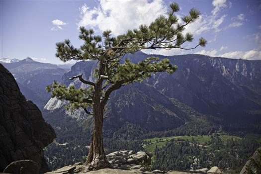
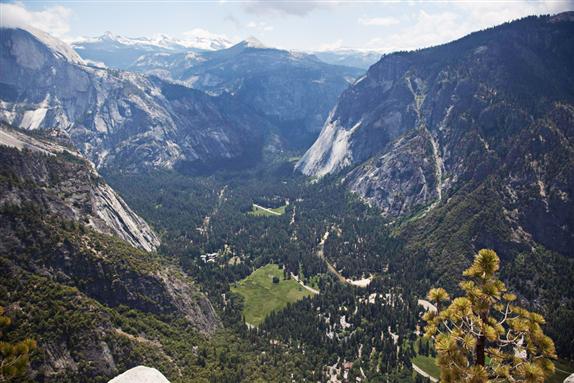
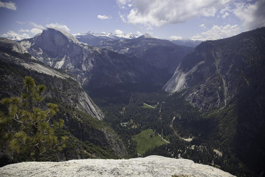
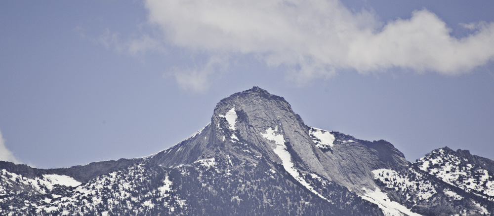
Just to the right of Half Dome you can see Mt. Clark. It's about 12 miles away.
Now how about those traverse ropes over to Lost Arrow that you saw from the lookout at the falls? Can you see the mountaineer perched on top of the spire?
If you look closely you can see two very small people dressed in black in the upper right corner of the right hand photo near the edge of a block.
After a few hours of lounging, eating and suntanning, it's time to start down since we got here in midmorning and it's now well after lunch.. I want to catch the bright skies for some photos of the falls part way down...
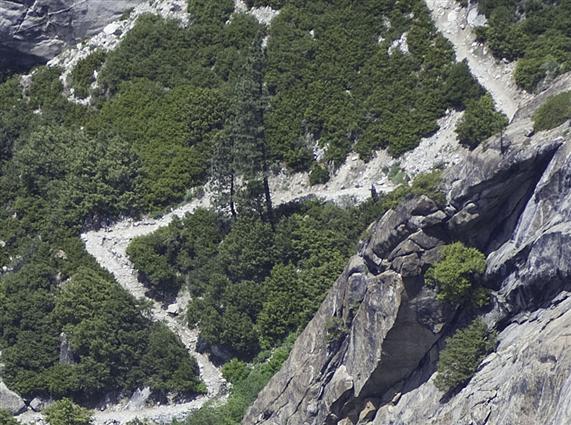
It's gonna be down the zigzags. A few people are still on their way up by the look of it. Usually when people are sitting they are taking a breather on the upswing climbing.
Maybe he's watching me watching him?
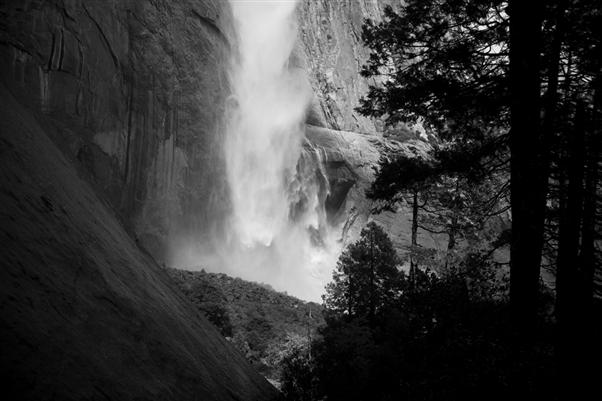
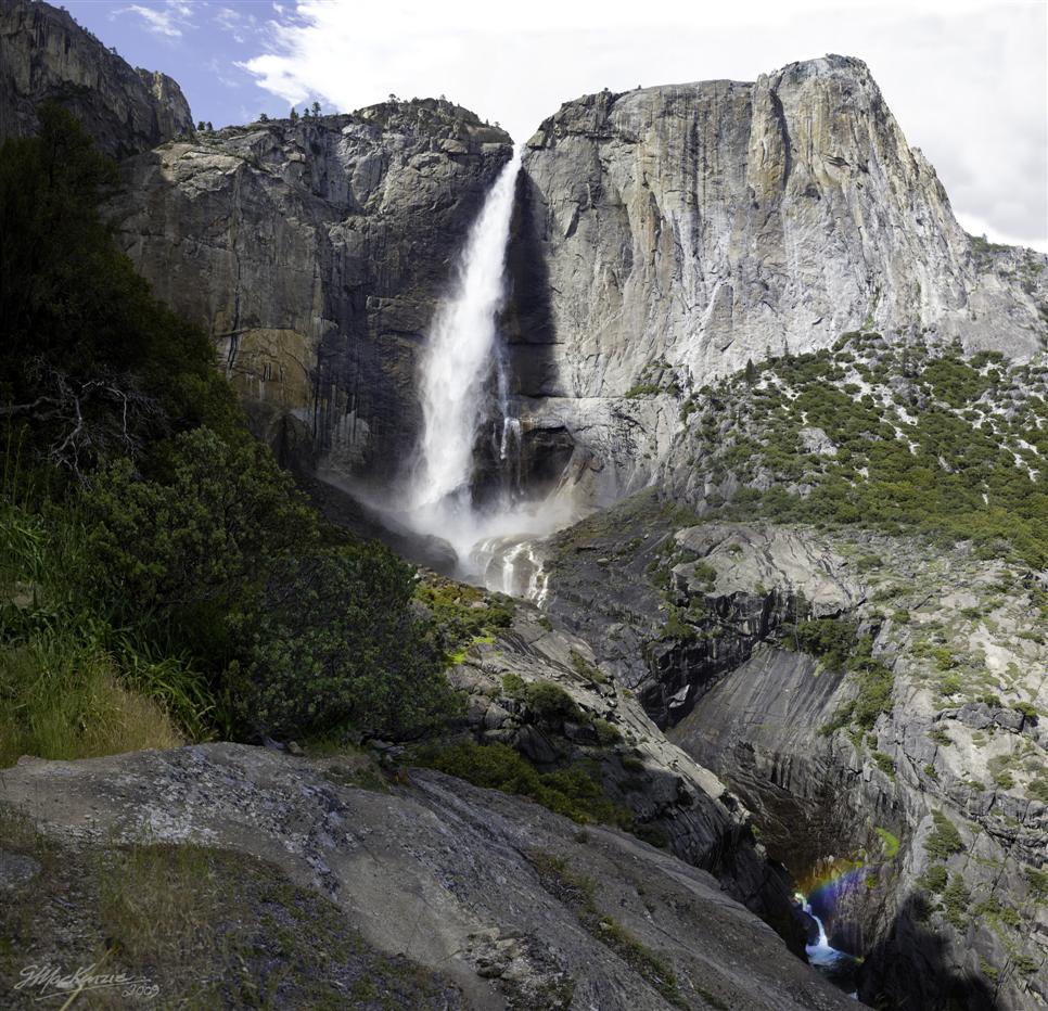
Down the zigzags then along towards Columbia Rock. A first view of the falls.
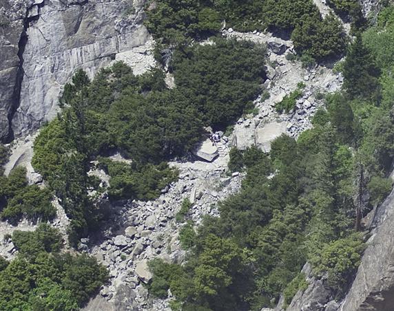
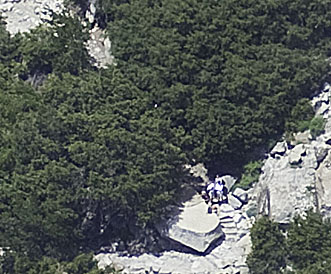
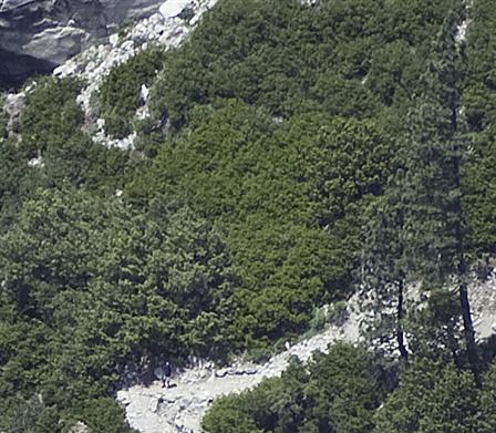
From the secret lookout off the trail... the main picture plus enlargements of two people just visible in the original high resolution 1/2 Gigapixel main image.
I can just see his head- the guy on the top of Lost Arrow I photographed a few hours ago.
Finally we are down. It takes me quite a while because I'm forever stopping to investigate overlooks, vistas and photos. Dave is enjoying a campsite rest while I dawdle.
It's still sunny and warm. Maybe the weather will be as good tomorrow.
zzzzzzzzzzzzzzzzzzzzzzzzzzz.......until tomorrow
Bright and early we are up. Actually, it's not very early, I'm not too bright and fully awake, and it sure ain't sunny. It's heavy overcast and drizzling. The birds aren't making much noise either.
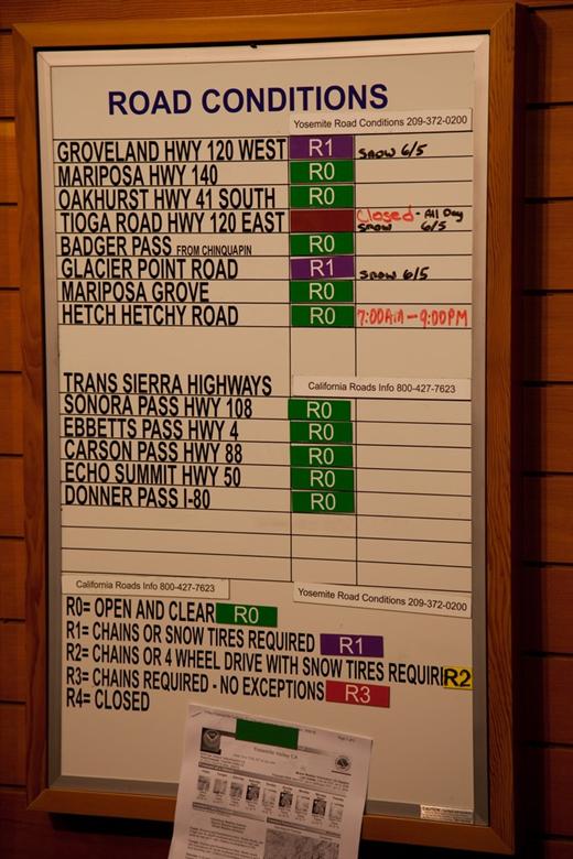
So it's off for a lazy breakfast and a coffee before heading over the Tioga Pass. But first, I head over to the bookstore for a few last minute things and to see the latest on road conditions and the weather forecast. ...
And it's a good thing too. Last night snow came heavy in the mountains. An avalanche has just closed the Tioga Pass. It went from R0 to R4 instantly. Not only that, but YOSAR teams (Yosemite Search & Rescue) are mounting up to get some of the ill-equipped people out of the upper hiking reaches and also people stranded in their cars up in the pass.
The Ranger at the weather board is standing by to update the list as new road closures may occur imminently. If the snow decides to hit the valley, it's very possible that the other roads out will close. First the road up to Hodgden Meadow, then the one to Oakhurst, and finally the one getting out via El Portal. Expect to stay put for a while if it happens. Roads usually don't just close for an hour hour or two.
In the case of heavy snow rather than continuous flurries, the roads go regularly from R0 to R3 or R4 in short order. We have 4 wheel drive (always plan to have this whenever you plan to explore in the Sierras) but it doesn't do much good for R3. The Rangers (with guns) don't fool around on mountain roads.
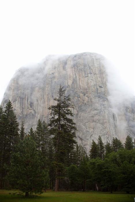
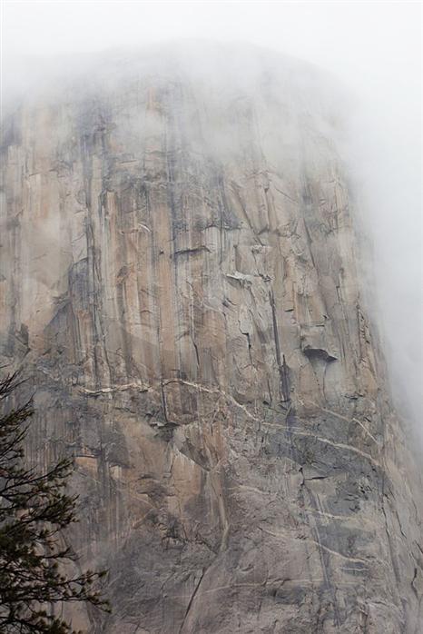
So we clear out and only stop for a couple of photos at Tunnel View before heading out toward Oakhurst. We have to go around the bottom of the Sierras near Mojave to avoid the road closures and the storms. Let's get out into the desert for some heat and sunshine!
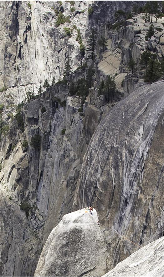
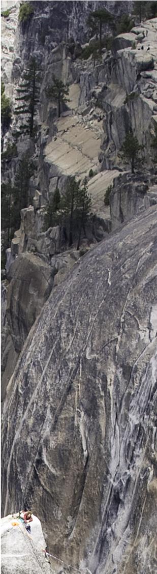
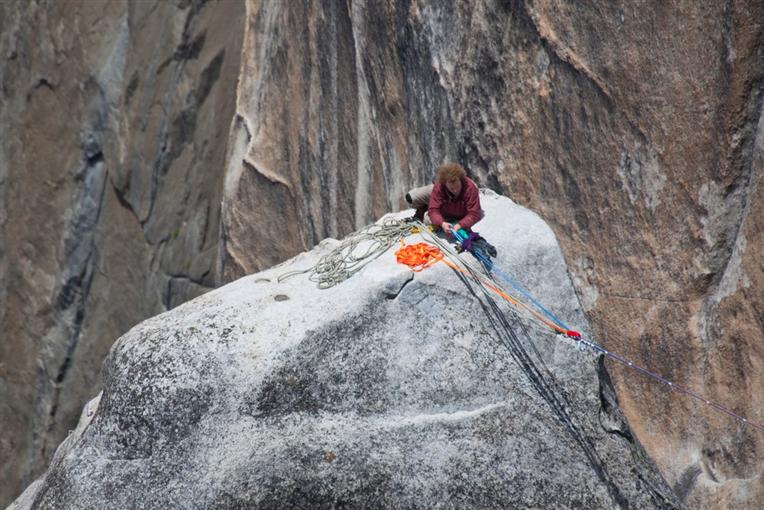
Climbers on El Cap are likely to have good clothing as they usually expect this sort of thing if you're going to be on the wall for a few days and nights. Can you see them on their perch?
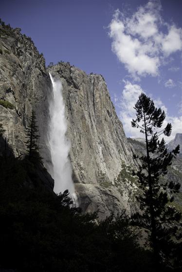
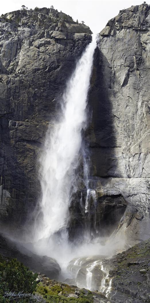
A Sunny Day's start at the top of Yosemite Falls
While up at the top, I meet two gals from Colorado who are avid hikers throughout North America. They are carefully taking pictures and videos no doubt for their own report. There's lots to see that's for sure.
On the way back from Yosemite Point I meet up again with Beth and her sister Diane. We have a great conversation and talk about various hikes done and enjoyed. They are very active and like to get out exploring all the time. If you want to see very creative and compelling video and photo stories of Yosemite and many other places, please have a look at their site, (Photodexbeth) sitting in Photodex at
To watch them you'll want to allow the (reputable) Photodex site to run a small ActiveX program. It's no problem , and well worth it. I plan to watch every single one of them, both for the imagery, and the great music matched to the stories. Start with the Yosemite 2009 trip and the Yosemite 2007 folder (Half Dome ascent success!!) Thanks Beth!
Grab a big hot coffee and a danish, then off we go. To get out we have to pass El Cap, so a photo or two makes sense.